Posts

Showing posts from February, 2018

BATUJAJAR CAVE, Kebumen's Tourism (Central Java-Indonesia)

Image
Jatijajar cave is a natural cave originally formed from limestone.   This cave was first discovered by a farmer named Jayamenawi in 1802. The story, while taking a grass in the field, he plunged into a hole.   A number of residents tried to help Jayamenawi by clearing the soil cover hole.   They found that the hole led into the cave.   It is estimated that the hole is a cave vent. The overall length of Jatijajar Cave from the entrance to the exit reaches 250 meters. While the height of the cave reaches 12 meters, width 15 meters, and the thickness of the ceiling 10 meters.   When measured from the surface of the sea, Jatijajar Cave height can reach 50 meters. In front of the Jatijajar Cave, there is a dinosaur statue as an important symbol of this cave.   Visitors who enter the cave will automatically pass through the mouth of this dinosaur statue.   This statue looks out of the water, as the mouth of the spring that is in the cave, which is from Sendang (River) Canton and Sen

The Grand Mosque of Purworejo, the Greatest Bedug Mosque in the World, Purworejo Tourism Religi (Central Java - Indonesia)

Image
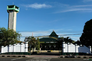
The Grand Mosque of Purworejo is a historical relic from the period of Islam in Indonesia. The Grand Mosque of Purworejo is also called the Jami 'Darul Mutaqqim Mosque.   The mosque is located in downtown Purworejo, precisely to the west of Purworejo square. Purworejo Grand Mosque is located in Kauman Village, Sindurjan Village, Purworejo Sub-District, Purworejo District.   Around the mosque there are several important buildings, including the residence of the Regent, Purworejo District Government Office, GPIB Church, as well as prisons and military-style buildings that now function as infantry headquarters 412. The history of the Grand Mosque of Purworejo is inseparable from the history of Purworejo itself.   Purworejo formerly known as Bagelan belonging to the Residency Bagelan.   Bagelan region in the nineteenth century is the territory of Nagara Agung Kasunanan Surakarta. The condition of Bagelan region that is less conducive encourages the Dutch to reassure the region by

DIENG PLATEU, Wonosobo and Banjarnegara Tourism

Image
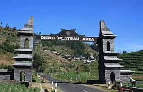
Dieng Plateau  is  Dieng Plateau  located in two districts of Wonosobo and Banjarnegara.   Dieng Plateau or Dieng Plateau is a popular tourist area that has many  attractions  for tourists who are on their way to Central Java.   Dieng has a wealth of diverse nature and abundant agricultural wealth. Variety of attractions Dieng tourists can find at every step.   The cool air, the vast farms, the beautiful mountains, the natural lakes, the gorgeous sunrise to the culture and the culinary that attracted the attractions of millions of tourists to Dieng Plateau. Since the first Dieng Plateau or Dieng Plateau has become the main destination of travel for the pilgrims because Dieng is a vast and challenging land for researchers, much of the history that is still buried in this Dieng Land.   Dieng has its own meaning that is from the word diyang or dihyang which has the meaning of place reside the Gods. Dieng is a plateau formed by the eruption of volcanoes around Dieng and even

MENJER LAKE NATURE, Wonosobo's Tourism

Image
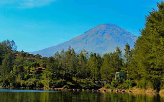
Menjer Lake  is the largest lake in Wonosobo district and is located at the foot of the mountains or Dieng plateau.   This naturally formed lake has been opened into a tourist attraction and used as a Hydro Power Plant (hydropower).   The potential of this lake tourism has not been explored and still rarely visited by tourists from both within and outside the region. Menjer Lake Nature is located in Menjer village, Garung District, Woonosobo, Central Java. Menjer Lake location as far as 12 km from Wonosobo city. Garung name reputedly related Rakyan Garung in the days of Queen Pramodhawardhani century VII-VIII M. The location of Lake Menjer from Wonosobo is closer to the Dieng Plateau.   The position of Menjer Lake is at the foot of the mountains or Dieng Plateau making it a potential tourist attraction that is close to the city center.   But the lack of information and signposts makes many travelers unaware of this place.   Many of the tourists go straight to the Dieng Platea

TWIN MOUNTAIN, SINDORO and SUMBING , Temanggung's Tourism

Image
Top of Sindoro Mountain Top of Sumbing Mount Sindoro and Sumbing Mount Sindoro  and  Sumbing  are two adjacent mountains, and have similar shape and height.   The height of Mount  Sumbing is  about 3,340 m (asl), slightly higher than  Sindoro  (3,155 m asl).   If mapped,  Cleft  is in the southwest of  Temanggung  city ​​and east of Wonosobo city.   While  Sindoro  in northwest  Temanggung  and East sea Wonosobo.   The community in both areas called  Sindoro  -  Sumbing  as Twin Mountain.   Both of them save huge  tourism  potential, although not all of them can be managed optimally. In addition to beautiful natural scenery, with cool and fresh air, the areas of the slopes of  Sumbing  - Sindoro  potential developed as a  tourist  agro area, especially plantation kelengkeng, tobacco, vanilla, and coffee.   The natural condition is almost the same as the Gunung Mas area, the peak, Bogor.   The mountain is filled with legends about the loyalty of the couple and the ep